All Projects
Production
AI-Powered Street Waste Detection & Cleanliness Index
Computer vision system that detects street-level waste and generates a city-wide Cleanliness Index, giving councils a data-driven view of urban cleanliness.
PyTorch Computer Vision Object Detection GCP Geospatial Analysis
Problem
Urban councils struggle to maintain consistent street cleanliness across large service areas. Without systematic monitoring, waste and debris accumulation often goes unnoticed until residents complain, leading to uneven maintenance and inefficient resource allocation.
Solution
As the primary model developer, I built the detection pipeline and designed the Cleanliness Index scoring methodology. The system integrates with the waste truck camera network to generate a quantitative, street-by-street assessment of urban cleanliness:
- Detection Model: PyTorch-based object detection pipeline trained to identify various types of street-level waste including litter, illegal dumping, overflowing bins, and road debris
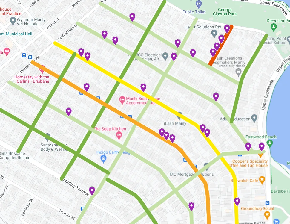
- Cleanliness Index: Each street segment receives a cleanliness score based on detected waste density and severity, visualized as a color-coded map (green → clean, yellow → moderate, red → requires attention) with individual waste markers
- Trend Analysis: Historical data enables tracking of cleanliness trends over time, identifying chronic problem areas versus one-time incidents
- Actionable Dashboard: Councils can drill down from city-wide overview to individual street segments, prioritizing cleanup resources based on objective data rather than reactive complaints
Impact
- Generating automated Cleanliness Index scores across all suburbs serviced by deployed councils, providing a comprehensive street-by-street cleanliness baseline
- Achieved reliable detection across diverse urban conditions with precision-focused tuning, reducing false waste reports that would otherwise waste cleanup crew time
- Enabled councils to cut average cleanup response time by shifting from reactive resident complaints to proactive, GPS-pinpointed dispatch — crews are routed directly to verified hotspots
- Provided the first objective, data-driven benchmark for comparing cleanliness across zones, supporting equitable resource allocation and measurable KPI tracking
Technical Highlights
- Transfer learning approach to rapidly adapt detection models across different urban environments
- Robust detection under varying conditions: shadows, partial occlusion, wet surfaces
- Geospatial data pipeline integrating detection results with mapping APIs
- Dashboard integration for council operations teams